Study and recognition of erosion characteristics of perennial and ephemeral rivers in Tehran province
Geophysics
DOI:
https://doi.org/10.14331/ijfps.2018.330111Keywords:
ARC GIS Soft wares, Erosion, Erosion Forms, River, System of rivers and stream Data, Tehran ProvinceAbstract
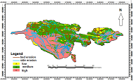
In current study, at the first step, the hydrographic net of province rivers were provided based on topography map and hydrographic net from Tamab Company of Iran. Based on these definitions, whole of Tehran province area was divided to 5 different areas . Based on these definitions, whole of Tehran province area was divided to 25 different areas. In this study, the areas comprises 415 streams, and long in about 3038 part that 55.5% area had low sensitive to erosion, 49.82 % area had moderate to erosion and 44.63% area had high sensitive to erosion. Based on geological study (Alluvial- Stone), 64.72% of area was categorized in alluvial class and 35.28% area was categorized in stone class. Based on sediments density, 26.61% area ranked in low density class, 17.05% area was ranked in moderate density class and finally 57.34% area was ranked in high density class. Finally, it in view of bed- marginal erosion, about 63.9% was grouped in marginal erosion class and about 36.10% was grouped in bed erosion class.
Downloads

Published
How to Cite
Issue
Section
License
Copyright (c) 2020 International Journal of Fundamental Physical Science

This work is licensed under a Creative Commons Attribution 4.0 International License.


